A Mansfield Triad
Since my days as a Middlebury College student, I've had some unfinished business with Mount Mansfield, Vermont's highest peak.
Back then I remember hearing about all the different trails one can climb to reach Mansfield's summit, as well as the unique habitat of Vermont's alpine tundra, which -- despite existing at an elevation of around 4,300 feet, an elevation lower than my distinctly non-alpine Colorado home -- is above timberline, with dwarf flora typical of 14,000-foot Colorado peaks. It would be another 7 or 8 years before I would hear about ultramarathons, let alone run one, but even back in the 1990s I remember thinking: I wonder how many times I could run up that mountain in one day, using how many of those different trails?
Then, the summer before my senior year at Middlebury, I became very ill, so my last year in Vermont was governed by the challenge of getting my health back while trying to graduate on time, rather than any more conventional endurance challenges. Any plans I had for a crazy multi-trail summit day on Mt. Mansfield were shelved for a while.
Flash forward fifteen years to this past week, when some business engagements led me back to Vermont. Though I didn't have time for a full "Mansfield Scramble," which is what Christi has dubbed this little endurance project, between appointments I managed to squeeze in three summits in four hours -- not a bad "down payment" on the full adventure, which I will complete on a future Vermont trip. Thanks to this "Mansfield Triad," I was able to become more familiar with the terrain and enjoy a gorgeous morning in the Green Mountains.

Planning this little adventure was made a lot easier by an awesome map of Mount Mansfield trails (small excerpt reproduced at left) recently published by the Green Mountain Club (you can purchase it at their website, and if you ever climb Mansfield I highly recommend that you do!) The map gives some topographical info, trail mileage, and driving directions to each of the trailheads. Since I didn't have a lot of time, this was the route I decided upon:
- Park at Underhill State Park;
- Ascent 1 via the Laura Cowles trail;
- Descent 1 via the Long Trail south;
- Ascent 2 via the Cliff Trail;
- Descent 2 via the Long Trail north;
- Ascent 3 via the Profanity Trail (Who can resist the opportunity to take a route with THAT name?! Not this girl.)
- Descent 3 via the Sunset Ridge Trail and back to the car at Underhill.
In the end I modified the plan a bit, running out of time with a storm approaching, but for the most part that's the route I stuck with, about 15 miles with around 8200 feet of climbing.
I'll have to wait for next time to have more accurate numbers, as my Garmin inexplicably went completely blank and unresponsive the morning of my adventure. (Grrrrr!!) but I took a lot of photos along the way so that I can still remember the trails well. So, without further ado, enjoy a few photos of the day's adventure!

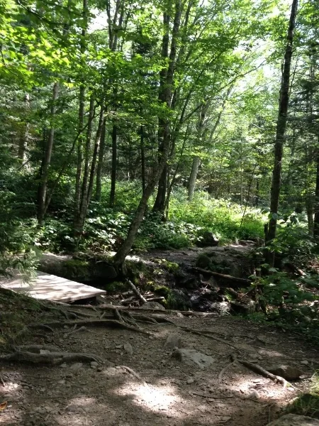
From Underhill State Park, this rooty but runnable single-track trail heads up for about 0.9 miles to a point where the trail splits into two parts: the Sunset Ridge Trail to the left, and the Laura Cowles Trail to the right. Both are options for a Mansfield summit, but since I'd heard the views coming down Sunset Ridge were spectacular I opted to climb via Laura Cowles and end the day with a descent down Sunset Ridge.
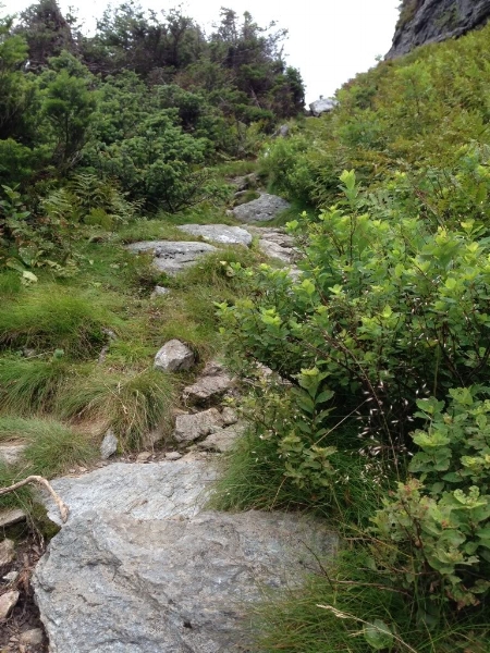
The Laura Cowles trail starts out as a fairly mellow trail that switchbacks along a creek, but before long, the swtichbacks stop and it's just a straight climb up, up, up! The last 1.5 miles or so are a bit like climbing an elevator shaft: it's hand-over-hand climbing up a slick creekbed. I was lucky to be ascending on a clear day; I imagine this trail would be dangerously slick if the water were coursing down any more strongly than it was.
The early trail builders of Vermont hadn't heard of switchbacks: trails that go up, go straight up!
Hard to tell in this photo, but this is a section where you're just climbing up a fairly smooth rock face, much steeper than it looks here... maybe a 70-degree angle. Fun, fun, fun!!
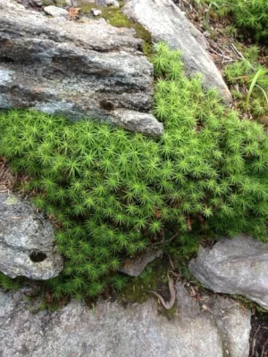
Close to the top, the vegetation starts to resemble the tiny plants one sees at very high elevations in Colorado.
I wondered about who Laura Cowles is or was, the whole time I was climbing. If she was anything like the beautiful, challenging trail named for her, she was a total badass, tough as nails, and drop-dead gorgeous. And as it turns out, that is pretty much the truth!
Laura Cowles was born Laura Golden in Minneapolis, MN and married native Vermonter Clarence P. Cowles in 1905. Clarence was a Princeton alumnus, then attended the New York Law School, and soon became a judge. Laura and Clarence were leaders in the Burlington community. Just four years after their marriage, Clarence became a member of the Burlington Board of Aldermen, while Laura taught piano lessons and had three sons and a daughter.
In 1910, they were founding members of the Green Mountain Club, the association that constructed the trails that comprise the Long Trail. Interestingly, not only did the Green Mountain Club admit women as members from the outset, but a number of women served as President of the group, notably Laura herself in 1918 and 1919. Laura was also the first woman ever to snowshoe to the summit of Mount Mansfield...and having hiked to the summit on a dry day, I can assert that getting to the top on snowshoes -- especially the cumbersome snowshoes people used back in the nineteen-teens -- pretty much guarantees that Mrs. Cowles was a total badass. I am sorry she passed away in 1958 as I would very much have enjoyed meeting her.
Looking south near the summit (at this point, Mansfield's summit is to the left and behind me.)
As the forest thins near the top of the Laura Cowles Trail (where that trail joins the Long Trail along the summit ridge) the views open up, and are just fantastic.

This sign appears at the spot where the Laura Cowles Trail hits the Long Trail. At this altitude, the plants grow very slowly and are fragile, and so numerous signs like this one encourage hikers to stay on the trail and as much as possible, walk on the rocks rather than on fragile vegetation.
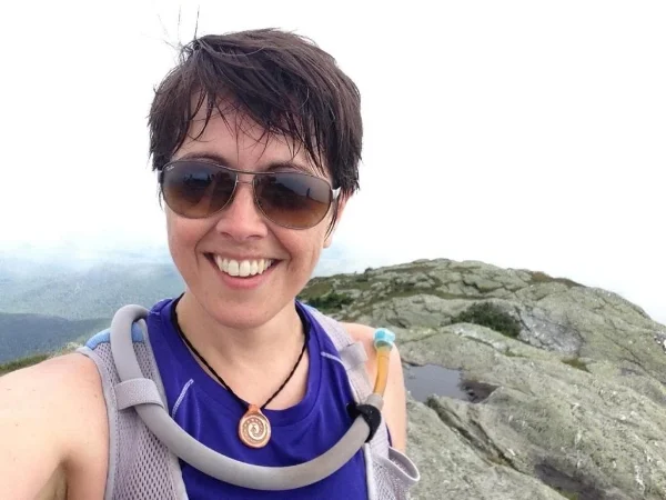
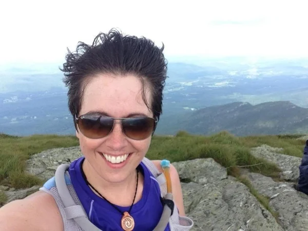
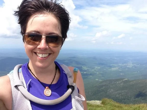
Summit #1! I'm facing south here; that's Canada you see behind me.
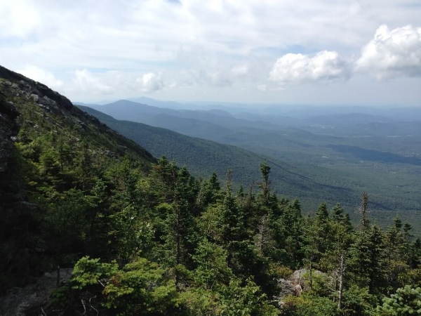
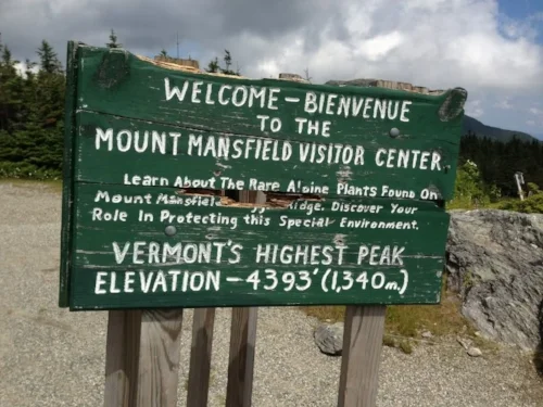
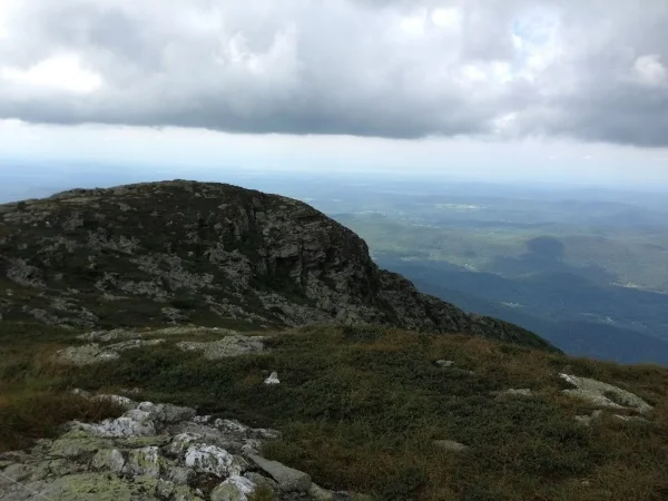
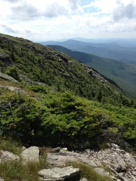
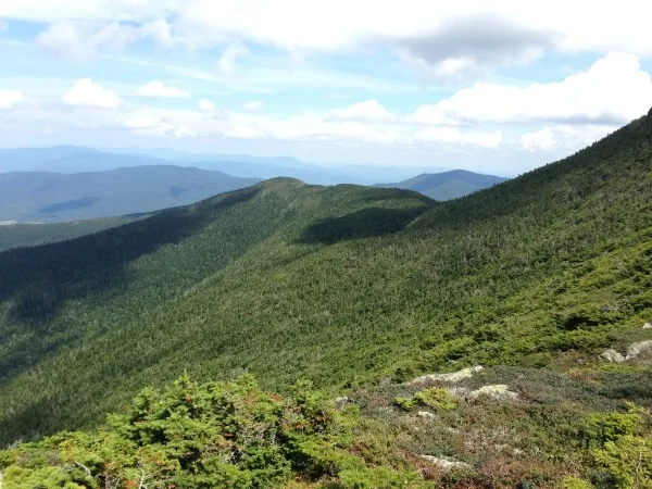
A bit south of the summit (heading south toward the Mt. Mansfield Visitors' Center on the Long Trail), looking west. Most of the morning these clouds came and went, but a bit later in the hike they would settle in and become more threatening.
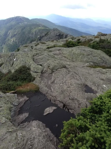
The summit ridge along the Long Trail heading south. I love all the alpine vegetation here, and the tiny pools that have emerged in low spots in the rocks.
It didn't take long to descend the 1.5 miles or so from the summit to the Visitors' Center. This section of the Long Trail is completely exposed, though, so plan to go on a clear day.
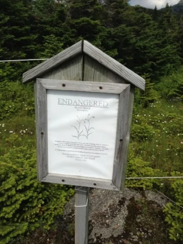
Signs in this area warn hikers to keep on the trails and avoid picking endangered Scabrous black sedge. I didn't see any; maybe they've already bloomed and gone to seed for the summer?
Ascent #2 was made by going north on the Cliff Trail. This trail hugs the eastern side of the summit ridge, about 400-500 feet lower than the Long Trail, which follows the ridge itself. Cliff Trail could be a good substitute for the more exposed Long Trail in a storm, but other than that it wasn't as scenic as the Long Trail and I wouldn't really recommend it.
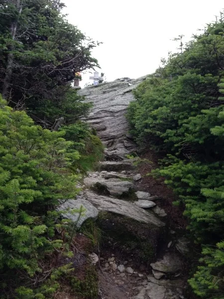
I snapped this photo at the spot where the Cliff Trail rejoins the Long Trail to continue north toward the summit. Definitely a steep "last push" to get up to the Long Trail, where the hikers in this photo are standing!
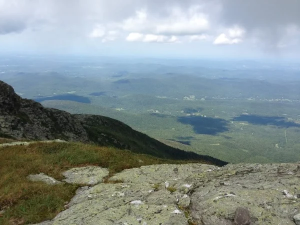
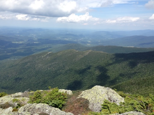
Summit #2, and the wind has really picked up! That's western Vermont and the Adirondacks behind me.
Another look west as I descend toward the long-awaited Profanity Trail!
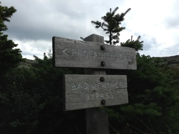
The Profanity Trail is apparently a "bad weather bypass" for this section of the Long Trail, but after having hiked on it I'd say it would probably not be a great trail to descend in bad weather, for the same reason as the Laura Cowles Trail: it is brutally steep, and I can only imagine that in bad weather, the water would come sluicing over the rocks in a way that would keep any hiker from seeing very well. It would also be quite slippery! But in a lightning emergency, it would be a quick trail to get lower than Mansfield's summit in a hurry. Especially if you fall. And if you survived the fall, you'd probably be spouting a lot of profanity...maybe that's how this trail got its name?
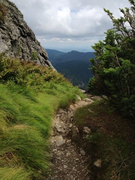
See how the trail disappears about halfway up the frame of this photo? That's because at that point, it drops straight down for a while. Very beautiful trail, though!
Coming back up the Profanity Trail. It's steeper than this photo makes it appear.
Summit #3, and more wind. What a great morning!
As planned, I descended back to Underhill State Park via the Sunset Ridge Trail. That turned out to be perfect, as the Laura Cowles Trail would've been tough to descend - like jumping down an elevator shaft - and Sunset Ridge Trail is not nearly as steep. Also, most of the way, Sunset Ridge Trail is fairly open, so the views are wonderful most of the way down.
Starting the descent down Sunset Ridge Trail.
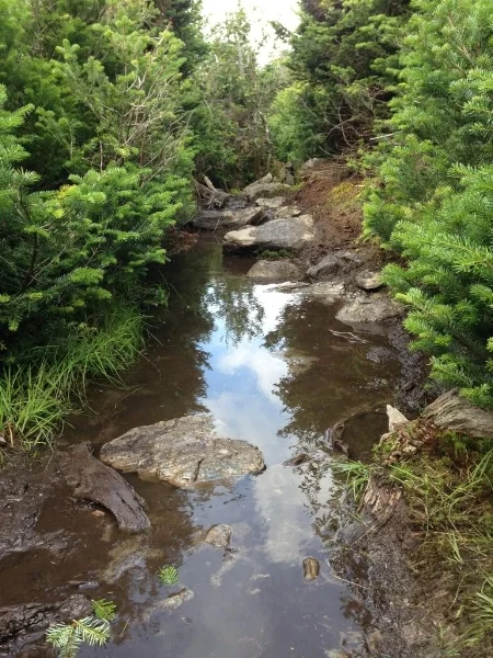
Parts of the Sunset Ridge Trail were quite muddy.
Looking north, not far below Mansfield's summit.
Looking northwest, continuing to descend.
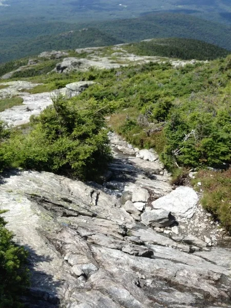
The upper part of the Sunset Ridge Trail is open and rocky, and the views go on forever. Cairns mark the route.
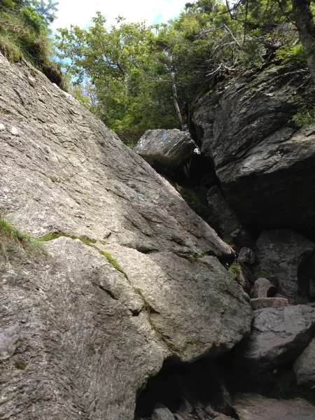
A small section of rock scrambling, just before the bottom of the trail, keeps the Sunset Ridge Trail interesting.
The last bit of Sunset Ridge is a very runnable meander through the trees, followed by a quick jaunt to the parking lot.
My "Mansfield Triad" was a lot of fun, but I'm already looking forward to my next trip up Mount Mansfield to do a full "Mansfield Scramble;" I've heard the Hellbrook Trail is an even more brutal ascent than the Laura Cowles Trail, so I've got to try it! A fourth summit would be awesome; I just need to plan for more time on the mountain next time around.
The Long Trail, and many of the trails around Mt. Mansfield are maintained by members of the Green Mountain Club, and regardless of where you live, I encourage anyone who uses these trails to become a member. I'm a proud member of the Bread Loaf section of the Green Mountain Club since I used those trails so often as a college student, and I hope to join them for some trail work next time I travel east. They do a fantastic job. Trails are well maintained and the signage is so well done that it would be hard to get lost up there.
I can't wait for my next trip to the Green Mountain State. In the meantime, happy travels, and see you on the trail!